

Several land areas in Colombia lack of formal registry and documents as a consequence of the absence of territorial information and the aftermath effects of the armed conflict. Through the intensive use of new technologies and innovative methodologies, the problem of characterization of vacant areas was addressed by using novel methods to consolidate land data and information, benefiting the farmers of the area.
Innovation Summary
Innovation Overview
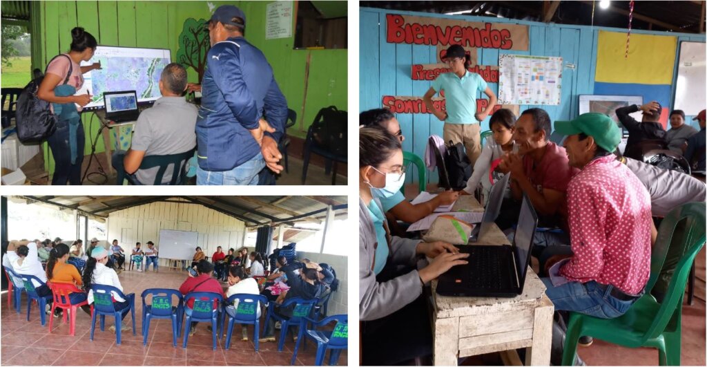
Applying Design Thinking to the existing land characterization in a polygon of 200,000 hectares, as well as Artificial Intelligence, satellite imaging, and online monitoring platforms, we developed a system to characterize the land in 3 municipalities. The benefits were immediate and impacted to 134,499 hectares of land, nearly 8.000 people and 1,900 properties. This innovation will allow the acknowledgement and registry of the properties, and because of its open source nature it can be replicated nationwide in territories with similar conditions.
Innovation Description
What Makes Your Project Innovative?
This is the first time that Colombia has accessed to geocadastral information in remote areas of the country. Similarly, it was the first time that mixed methods that interplay technology and data such as satellite imagery, 4RI technologies and public record of the cadaster were used.
Innovation Development
Collaborations & Partnerships
Several beneficiary groups:
-Organization of Ibero-American States - Innovation Center: Executor - Project Methodology - Articulator - Cooperating Partner
-European Union - European Fund for Peace: Financier - Support to Peace Process
-Colombian National Land Agency: Government - Definition of Standards and Goals
-Universidad de los Andes: Academia - Artificial Intelligence Model.
-Geoprojections: Company - Survey of Information in Territory
-Colombian Space Agency: NGO - Technology and Satellite Images".
Users, Stakeholders & Beneficiaries
As main stakeholders and beneficiaries we identify:
-Agencia Nacional de Tierras de Colombia (Government) - National Agency of Empty Lands
-10 local Civil Society Associations
-1900 benefited families to receive their property titles
-SpaceLab - Universidad de los Andes (Academia)
Innovation Reflections
Results, Outcomes & Impacts
The innovation allowed the characterization of more than 130,000 hectares, 1900 properties, in 3 municipalities, benefiting more than 8,000 people.
For monitoring and measurement, an online monitoring platform was designed for all project components. The measurement methodologies are subject to the institutional procedures of the partner entities. In the future, this project will continue to advance in the territorial characterization of the country.
Challenges and Failures
The main challenges was the lack of baseline information and the digital gaps among civil servants in relation to the use of ICTs.
Conditions for Success
The main condition for success is the proper articulation and linkage of allies who share the same purposes. The articulation of applied research from academia, the understanding of the needs and challenges of the government, the experience of the private sector and the proper appropriation of the benefits for civil society.
Replication
This project can be replicated country-wide as the needs and requirements for geo characterizing empty land areas are similar. This project leaves lessons on innovation methodologies and the social processes during the implementation process.
Lessons Learned
The design thinking approach allowed exploring different technologies, methodologies and understanding the context; in general, being able to prototyping tools and measure risks. The collaborative innovation process, involving actors and professionals from different disciplines, allowed the consolidation of the idea, its development and its culmination. Being able to see the innovation process from different points of view made it possible to minimize the uncertainties inherent to any innovation.
Status:
- Implementation - making the innovation happen
- Diffusing Lessons - using what was learnt to inform other projects and understanding how the innovation can be applied in other ways
Open Government Tags
enablersInnovation provided by:
Media:
Files:
Date Published:
22 November 2022