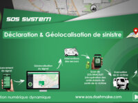
More than 150,000 Togolese have downloaded the SOS Systems application, which helps precisely locate the place of occurrence of a disaster, can identify the health history of an unconscious victim by scanning the QR code of the bracelet, and shares daily health tips and tricks.
Innovation Tag: Geolocation and Mapping
The central government is improving social and urban integration of informal settlements faster than ever. Through a collaborative approach, we invited social organizations to design and conduct the 1st National survey of slums. With a mobile app and training, the inhabitants of the neighborhoods help in the process. Then, the families received a Certificate that allows them to request public services.
La cartographie des projets permet de géo-localiser et suivre l’avancement des projets inscrits au projet de mandat « Loiret 2015- 2021 » de manière simple et intuitive grâce à un reporting directement alimenté par les chefs de projets du Département.
An emergency event in a neighbouring authority highlighted how hard it was to identify vulnerable persons during a confirmed gas leak, Falkirk Council resolved to find a faster, more accurate and secure method for quickly identifying those in need during any type of emergency incident where local residents might be in danger. Data was cleansed and uploaded to an electronic mapping system which allows us to identify vulnerable persons in a few simple clicks and has been hailed as quantum leap.
NRCan's Office of Energy Efficiency (OEE) Social Innovation UnLab (SIU) is working with program colleagues and Carrot Insights to deliver an energy efficiency rewards pilot via the Carrot Rewards mobile app. Our hypothesis: Engaging Canadians on their smartphones and gamifying learning and action will improve awareness and adoption of energy-efficient behaviours. The pilot is delivering results and entering its third phase this year (2018).
Instead of composting or incinerating invasive alien plant species, we are developing new ways how to process them into new, useful products (paper and wood products, dyes and hybrid coatings, extracts for controlling of plant harmful organisms, food source, input materials for the industries of the future and 3D composites). Invasive alien species are a locally accessible and abundant resource and opportunity for a new business model, promoting zero‑waste approach and circular economy.
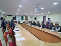
Learning from the challenges of 2015 Nepal Earthquake where geo-spatial data was at a premium, Kathmandu Living Labs implemented a project that created a robust geo-spatial database for the entire Pokhara Lekhnath Metropolitan City. The ownership of this dataset was passed to the local government. The project opened the door for open mapping to be adopted by the government, engaged local citizens to map their neighbourhoods and encouraged local government to make use of spatial data.
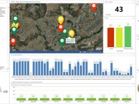
The Environmental Sanitation Company of the Federal District of Brazil uses of spatial intelligence to reduce water consumption, increase revenues and optimize process.
The purpose of this app is to alert citizens, especially the ones with health problems, about the current and near-future conditions at their current location. This app is linked to complex algorithms developed by scientists at Masdar Institute using real-time satellite data and weather forecasting models. This app issue warnings on air quality and dust concentration to the public and especially to asthma-effected population. Real-time data is updated each 15 min.
Forest fires affect many parts of Southeast Asia, resulting in extensive environmental destruction, health problems, school closures and transport cancellations. Haze Gazer is a web‐based decision support system for disaster management authorities which harnesses multiple sources of data to provide insights on haze disaster dynamics.


