
In 2016, Ukraine launched an electronic asset declaration system, requiring public officials to disclose earnings and assets, in an effort to combat corruption and enhance accountability of public figures. With support from international partners, the e-register system hosts a global database of assets of public officials and has over 1,450,000 registered users.
Innovation Tag: Data

The Buenos Aires City Government launched Climate Action, an open data platform that brings together energy efficiency, sustainability and waste management policies to combat climate change in the city. The platform is based on transparency, co-creation, collaboration, citizen participation, accountability and innovation. BA Climate Action was co-created with civil society organizations, environmental experts and citizens.
Better Insights into Collective Climate Actions: The currently fragmented, insufficient and incompatible sources building the climate data framework remain a critical threat to a successful outcome of the 2023 Global Stocktake for the Paris Agreement. While we observe an increasing amount of participation, effective ways of connecting, visualizing and analysing actors patterns & impact, within the overall climate initiatives, remain limited.

The techDetector is the first technology radar giving an overview of emerging technologies that have the potential to influence the area of sustainable development in the future. It lists future technologies from all sectors of sustainable development and assesses their potential impact on sustainability and gender equality. The techDetector helps inform, sensitize and support foresight processes, enabling better decision-making by providing sound information on technological developments.

The NSW Government has developed a whole of government spatial tool to improve planning and pre-development processes. The tool modernises the traditional approach to strategic planning, site assessment & land use evaluation and provides user friendly access to GIS capabilities where multiple agencies can work together on a project in NSW public sector. Through this, government agencies are enabled to make faster, better informed, more transparent and consistent decisions on NSW land.
First platform in the industry which support standalone and integrated workflow solution for any inspection,which leads to increased efficiency,security,and accuracy of inspection operations through virtual-inspection capability that enables the inspection teams to work remotely and reduce the need for field visits and addresses some pain points which includes inconsistency in quality,time consumption and resource management.stakeholders include Inspectors, Schedulers ,System admin,inspected org
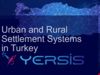
Socioeconomic relations of all levels of settlements are examined with big data at the scale of the smallest settlements to the metropolitans (81 provinces, 973 districts and 37.036 rural units) in Türkiye. The attributes, needs and comparative advantages of each of the settlements analyzed in YER-SIS with an innovative methodology will enable evidence-based national and regional development policies. Public and private sectors, universities, and NGOs are primarily users benefiting from…
Case Study
Innovation Zones, Facets and Beyond – LIEPT (Lund Innovation Ecosystem Portfolio Tracking)…
To provide a systematic approach for initiating and tracking collaborative development processes over time and inform investment decisions in multi-stakeholder environments, Future by Lund (FBL) has implemented a new model for innovation ecosystem portfolio tracking (LIEPT). The model benefits partnering stakeholders by building strategic competence for scaling solutions and working with innovation portfolios as an approach for governing and developing the ecosystem’s priority areas.
The AJSC has developed a new model to measure the determinants of the ‘quality of life’ in Ajman, covering six key areas of public service. The Model comprises a comprehensive factor measurement framework embedded on a sophisticated web-based application, with inbuilt protocols for scientific data collection, project management, data visualization and reporting. It systematically measures gaps and impact of interventions, via targeted performance assessment of framework factors.
The reason for creation was to improve inspection models of external control, which were based mainly on legality and conformity. IEG-M index is an instrument for measuring public area effectiveness, as it analyses the inputs, resources and processes of the local administration, evaluating its policies and activities. There are many finalistic results indexes, but none of them deals with the evaluation of processes to analyse the application of public money that impacts local communities.