Water networks are confronted with aging infrastructure, increased urban population, and climate change. The City of Greater Sudbury has collaborated with CANN Forecast to implement InteliPipes, an AI-based decision-support system that leverages various data sources to improve the overall reliability of its water network. With it the City can (a) understand better the network’s degradation over time, (b) tailor inspection plans and replacement programmes, and (c) optimise watermains…
Innovation Tag: Open Data
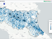
Emilia-Romagna’s Digital Agenda led a significant innovation process for public administration decision-making. The process resulted in a co-design phase with local administrations to structure and publish online the first geo-referenced regional Observatory on ultra-broadband connectivity in Italy. Multi-stakeholder participation made it possible to identify and highlight the various strengths and weaknesses of the tool, enabling its optimisation.
Explore.Porto challenges citizens and visitors to discover and explore the city. The service is provided through a digital platform, anchored in beacons placed in strategic points in Porto. Anyone equipped with a smartphone can instantly obtain information about where they are and their surroundings, as well as the best way to get around. This user-centered innovation has proven its impact on the adoption of local services by both citizens and visitors.
In 2016, Ukraine launched an electronic asset declaration system, requiring public officials to disclose earnings and assets, in an effort to combat corruption and enhance accountability of public figures. With support from international partners, the e-register system hosts a global database of assets of public officials and has over 1,450,000 registered users.
The Buenos Aires City Government launched Climate Action, an open data platform that brings together energy efficiency, sustainability and waste management policies to combat climate change in the city. The platform is based on transparency, co-creation, collaboration, citizen participation, accountability and innovation. BA Climate Action was co-created with civil society organizations, environmental experts and citizens.
Better Insights into Collective Climate Actions: The currently fragmented, insufficient and incompatible sources building the climate data framework remain a critical threat to a successful outcome of the 2023 Global Stocktake for the Paris Agreement. While we observe an increasing amount of participation, effective ways of connecting, visualizing and analysing actors patterns & impact, within the overall climate initiatives, remain limited.
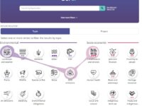
Governments are buried in hard-to-search PDF documents that hold data with great value for citizens, scientists, and public servants. At the Canada Energy Regulator, we developed data science methods to liberate 20 years – and tens of thousands of kilometres – of environmental and socio-economic data from over 1900 PDF documents from oil and gas pipeline applications. We made it easy to search and explore this data in our powerful and user-friendly search tool, BERDI.
The AJSC has developed a new model to measure the determinants of the ‘quality of life’ in Ajman, covering six key areas of public service. The Model comprises a comprehensive factor measurement framework embedded on a sophisticated web-based application, with inbuilt protocols for scientific data collection, project management, data visualization and reporting. It systematically measures gaps and impact of interventions, via targeted performance assessment of framework factors.
The reason for creation was to improve inspection models of external control, which were based mainly on legality and conformity. IEG-M index is an instrument for measuring public area effectiveness, as it analyses the inputs, resources and processes of the local administration, evaluating its policies and activities. There are many finalistic results indexes, but none of them deals with the evaluation of processes to analyse the application of public money that impacts local communities.
Case Study
Procurement Planning Platform (PPP) for driving Sustainability, Circularity and Innovation in Lisbon…
Lisbon Municipality aims for more innovation and sustainability in Public Procurement. Urgency and specifications' complexity are excuses for not considering sustainability in tenders and barriers to attracting innovative SMEs and startups. The innovative approach involved users designing and developing the Procurement Planning Platform, using a rapid development tool, cloud-based, and agile methods, which selects and supports a project-led approach for deploying new procurement strategies.


